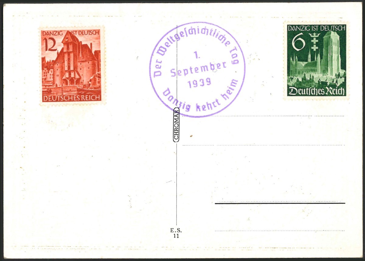
PROPAGANDA POSTCARDS
(1939)
This page was last updated
21-Feb-2025 08:22

THE GERMAN GAU
(1st Sep 1939)
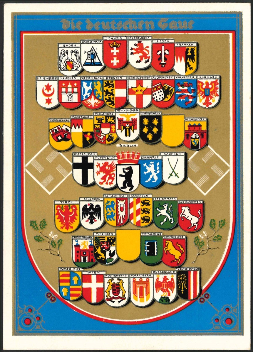
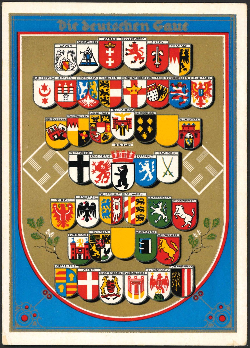
BACKGROUND: This impressive postcard celebrates the various administrative regions (Gaue) of Nazi Germany. The card shows the emblems of the 40 Gau that existed at the time its publication (there are 42 shields shown but two are blank). The system was introduced in 1934 but has its origins in the Weimar Republic days of 1926. Originally there were 32 Gau, but this number rose steadily to a total of 42, after the occupation of Austria and the Sudetenland and other German gains during the war. Each Gau was headed by a Gauleiter or Gau Leader, some of whom weilded total control over their individual regions.
SPECIAL CANCEL: NONE

The GAUE LISTINGS
The following is a list of the Gaue as shown on the postcard above from left to right and top to bottom.FIRST ROW:
1. BADEN
2. BAYR OSTMARK
3. DANZIG
4. DÜSSELDORF
5. ESSEN
6. FRANKEN
SECOND ROW:
7. HALLE-MERSEBG
8. HAMBURG
9. HESSEN-NASS
10. KARTEN
11. KOBLENZ-TRIER
12. KÖLN-AACHEN
13. KURNESSEN
14. KURMARK
THIRD ROW:
15. MAGDEBURG-ANHALT
16. MAINFRANKEN
17. MECKLENBURG
18. MÜNCHEN-OBERBAYERN
19. NIEDEROSTERREICH
20. BLANK
21. OST-HANNOVER
FOURTH ROW:
22. OSTPRUSSEN
23. POMMERN
24. BERLIN
25. SAARPFLAZ
26. SACHSEN
FIFTH ROW:
27. TIROL
28. SCHLESIEN
29. SCHLESW-HOLST
30. SCHWABEN
31. STEIERMARK
32. SÜD HANNOVER
SIXTH ROW:
33. SUDETENLAND
34. THÜRINGEN
35. BLANK
36. WESTFALEN SÜD
37. WESTFALEN NORD
SEVENTH ROW:
38. WESER-EMS
39. WIEN
40. WÜRTTEMBURG
41. VORARLBERG
42. BURGENLAND
43. OBEROSTERREICH